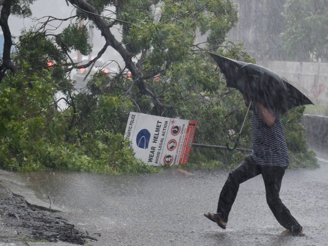
Cyclone Yaas to hit Bengal, Odisha by May 26, bring heavy rainfall
The West Coast is still picking up the pieces after the Tauktae attack, and the East Coast is gearing up for Cyclone Yaas, set to hit the coast next Tuesday; squally winds can be expected from Sunday, says IMD

Even as the western coast of India is picking up the pieces after being battered by Cyclone Tauktae, the India Meteorological Department (IMD) has said coastal Odisha and West Bengal will receive heavy to very heavy rainfall from the evening of Tuesday, May 25.
This will be caused by a new cyclone — named Yaas — that is likely to hit the east coast by May 26.
New Low Pressure area likely to form in Bay of Bengal around 22 May To intensify into a Cyclonic Storm and reach West Bengal and Odisha Coast by 26 May. Sea conditions to remain rough in Bay of Bengal from 21 May onwards. Fishermen requested to return to shores.#CycloneAlert pic.twitter.com/eHnInU33y2
— NDMA India | राष्ट्रीय आपदा प्रबंधन प्राधिकरण ?? (@ndmaindia) May 19, 2021
“The south-west monsoon is very likely to advance over south Andaman Sea and adjoining southeast Bay of Bengal around May 21, in association with the likely strengthening and deepening of south-westerly winds over the region,” said an IMD press release.
“Other atmospheric and oceanic conditions like conducive environment for convection, sea surface temperatures are also remaining favourable for persistent cloudiness over the Andaman Sea and adjoining areas of east central and south-east Bay of Bengal around May 22. Hence, a low-pressure area is very likely to form over north Andaman Sea and adjoining east-central Bay of Bengal around May 22,” it added.
Following this, from Tuesday evening, the coastal areas of Odisha and West Bengal will witness heavy to very heavy rainfall, it is predicted. Fishermen have been advised not to enter the sea from Saturday evening.
Strong winds
Squally winds with speeds reaching 4,555 kmph and gusting to 65 kmph is likely to prevail over the Andaman Sea and adjoining east-central Bay of Bengal on Sunday, the IMD further said.
Re-Up: Cyclone Alert In Bay Of Bengal: Odisha To Face Extremely Severe Storm?#CycloneAlert #CycloneInOdisha #Odisha https://t.co/SpQz069AIG
— OTV (@otvnews) May 19, 2021
“It is very likely to increase, becoming 5,060 kmph, and gusting to 70 kmph from May 23 and further becoming gale wind speed during May 24-26 over major parts of central Bay of Bengal and along and off Odisha West Bengal Bangladesh coasts during May 25-27,” it added.
Also read: Cyclone Tauktae helps sea return Mumbai’s garbage
Meanwhile, on Wednesday, the remnant of extremely severe cyclonic storm Tauktae over southeast Rajasthan and neighbourhood moved north-eastwards, said the IMD. It moved with a speed of about 37 kmph over 6 hours, and lay centred at 11.30 am on Wednesday over east Rajasthan, it added.
“Cyclone Tauktae is very likely to move north-eastwards and weaken into a well-marked low-pressure area and move further north-eastwards across Rajasthan to Uttar Pradesh during the next two days,” it said.
The organisation further said light to moderate rainfall is likely at most places, with heavy to very heavy falls at isolated places, over east Rajasthan on Wednesday.


