


- Home
- India
- World
- Premium
- THE FEDERAL SPECIAL
- Analysis
- States
- Perspective
- Videos
- Sports
- Education
- Entertainment
- Elections
- Features
- Health
- Business
- Series
- In memoriam: Sheikh Mujibur Rahman
- Bishnoi's Men
- NEET TANGLE
- Economy Series
- Earth Day
- Kashmir’s Frozen Turbulence
- India@75
- The legend of Ramjanmabhoomi
- Liberalisation@30
- How to tame a dragon
- Celebrating biodiversity
- Farm Matters
- 50 days of solitude
- Bringing Migrants Home
- Budget 2020
- Jharkhand Votes
- The Federal Investigates
- The Federal Impact
- Vanishing Sand
- Gandhi @ 150
- Andhra Today
- Field report
- Operation Gulmarg
- Pandemic @1 Mn in India
- The Federal Year-End
- The Zero Year
- Science
- Brand studio
- Newsletter
- Events

Why Nepal-Tibet floods have brought back memories of an 'unforgiving' Kailash trek for this Indian
The Bengaluru resident who undertook the trek to Kailash Mansarovar in Tibet last year mulls over how little it takes for a difficult journey in high altitudes to become a dangerous one.

Almost a year has passed, but my body has not forgotten the 52-kilometre trek around Mount Kailash. The peak, at an elevation of approximately 6.6 metres above sea level, is part of the Trans-Himalayas in Tibet, close to the Nepal-China-India trijunction and is considered sacred by those practising Hinduism, Buddhism and Jainism. Close by is the Mansarovar lake, also held in reverence by...
Almost a year has passed, but my body has not forgotten the 52-kilometre trek around Mount Kailash. The peak, at an elevation of approximately 6.6 metres above sea level, is part of the Trans-Himalayas in Tibet, close to the Nepal-China-India trijunction and is considered sacred by those practising Hinduism, Buddhism and Jainism. Close by is the Mansarovar lake, also held in reverence by Hindus, Buddhists and Jains.
The Kailash parikrama (ritualistic circling of an object of reverence) is unforgiving even in the best of conditions.
Which is why when I read of the devastating floods that originated in Tibet this week before sweeping through Nepal — reportedly caused by a glacial collapse in the upper Himalayas, leaving hundreds of travellers, including Kailash Mansarovar pilgrims, missing or stranded — I found myself thinking about the landscape I had crossed so recently and how little it takes for a difficult journey in the high mountains to become a dangerous one.
There are four routes into Tibet for the Kailash Manasarovar Yatra, with the Nepal routes generally favoured by travellers coming from outside India. Some private tour operators from India also reportedly take the Nepal route, which includes the two commonly accessed approaches of the Simikot-Hilsa in Humla and Kathmandu-Kerung through Rasuwagadhi. On the Simikot-Hilsa route, the journey begins with a flight from Nepalgunj to Simikot, at about 2,900 metres, before continuing towards Hilsa on the Nepal-Tibet border, at around 3,600 to 3,700 metres.
Most travellers using the Kathmandu route cross from Rasuwagadhi on the Nepal side into Tibet through Gyirong. Here, the road is literally a narrow passage through an unforgiving landscape and the only way in or out. The route follows steep-sided valleys, with mountains rising almost vertically from the road and a fast-flowing river far below in the valley. During the monsoon, those same slopes can become unstable, sending rocks and mud onto the road, while swollen rivers can wash away bridges and sections of the highway. Beyond the border, the road climbs towards the Tibetan Plateau and higher elevations.
On the Indian side, the more traditional route is through the Lipulekh Pass on the India-China border. The overland journey from Lipulekh Pass to Darchen in Tibet covers approximately 135 to 140 kilometres, beginning with a high-altitude border crossing at 5,334 metres from Uttarakhand. After crossing into Tibet, travellers descend about 30 to 35 kilometres to Taklakot for immigration and security clearance. From there, the road heads north, bypassing Lake Manasarovar before ending at Darchen. The route is generally described as moderate to difficult.
Wanting to circumvent as many physical challenges of the yatra as possible, I chose the Nathu La Pass route from Sikkim, described by tour operators as ‘easy to moderate’. This route is available only through the government-run yatra and presents a different kind of Himalayan challenge.
Also read: What Indian mountaineers feel about Nepal’s likely move to make permission for Everest climb tougher
Much of the journey to Darchen from here, at about 4,600 metres, is through the high Tibetan Plateau, with much of the route above 4,300 metres. Formal entry, passport stamping and customs clearance take place at the official border facility after crossing Nathu La (4,300 metres). The security scrutiny is intense. Officers routinely inspect smartphones, including photo albums, deleted folders, chat history and hidden folders. I had a picture of the Dalai Lama in a photo folder and was briefly grilled/questioned about it.
Once the formalities were over, the first stop in Tibet was Kangma, at 4,176 metres, a gentle dip in altitude, followed by a further descent the next day to Lazi at 4,053 metres. Then came the climb to Zhongba, at 4,728 metres, on the third night, before we finally reached Darchen.
I am generally fit. For three weeks after being selected through a computer-generated lottery, I trained specifically for the trek, climbing 12 flights of stairs with a 5-kilogram backpack twice a week and running or brisk-walking about 10 kilometres on the other days.
But nothing prepares you for high altitude. Acclimatisation was tough. On my first night at Kangma, despite being at a lower altitude, I experienced a full-blown panic attack, convinced that I was dying. The Indo-Tibetan Border Police doctor travelling with our group said such episodes were common at high altitude and urged us to go to bed early and get a good night's sleep. Without adequate rest, he explained, oxygen saturation in the blood, SpO₂, could fall sharply, contributing to altitude sickness.
In spite of overall breathlessness, the bus ride from our hotel in Darchen to Yam Dwar was exhilarating. Yam Dwar, near Tarboche in western Tibet, is the traditional starting point of the outer kora of Mount Kailash, at an elevation of about 4,724 metres. The crisp mountain air and the buzz of travellers gathering to be assigned a pony and porter briefly displaced some amount of anxiety. The wait lasted at least an hour.
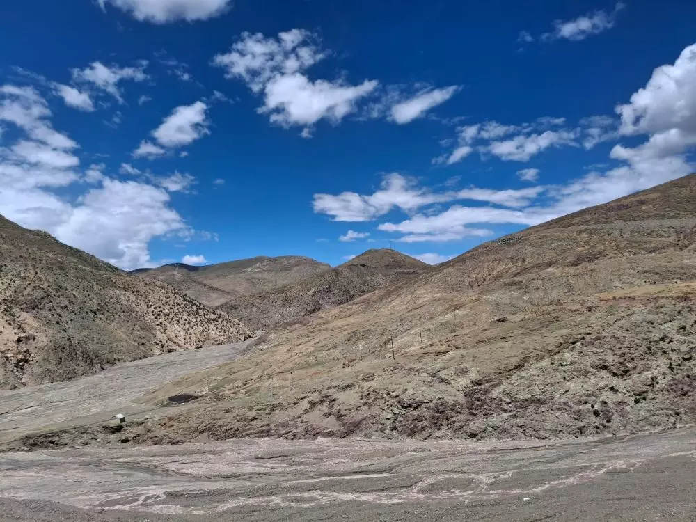
On way to Darchen. Photo: Jayanthi Madhukar
From there, the landscape begins to change. The trail follows the fast-flowing Lha Chu River through a high-altitude mountain valley. The principal natural hazards here are rockfall, landslides and debris movement, as well as sudden runoff from snowmelt. Last May, a major flash flood devastated the village of Til, roughly 100 kilometres south of Mount Kailash. According to reports, investigations suggested that meltwater associated with a high-altitude frozen lake or permafrost may have accumulated and then suddenly drained, producing the flood.
My Tibetan guide tried to explain why the trail we were walking on was safe. But, as he admitted, nature was undefeated and unpredictable in this region. Barely an hour into the parikrama, I began to understand what the journey would demand. Oxygen, which we take for granted in most of the world, was suddenly scarce. I stopped several times to catch my breath.
Later, my guide offered his own words of wisdom. “You can’t train for the altitude,” he said, grinning a wide, toothy smile exposing nicotine-stained teeth. “You have to be a smoker to handle the altitude.”
I was already gasping for breath, concentrating on placing one foot in front of the other and trying not to look at how far I still had to go to Dirapuk, our overnight stop about 12 kilometres away. “Smoking, huh?” I managed a feeble smile at the irony of having ‘good’ lungs in a place where the air seemed determined to prove otherwise.
The sight of Mount Kailash throughout the trek was its own reward.
One of our fellow travellers dramatically removed his hiking boots, determined to complete the parikrama barefoot. My guide shook his head and spoke to the other guides in Tibetan, clearly unimpressed by the bravado. By evening, at Dirapuk, the same traveller had become something of a hero but with bleeding and swollen feet after completing the day's trek.
The night in the rudimentary dormitory was the toughest of the two nights on the parikrama. I slept in the same clothes I had worn for the trek, with neither the energy to change nor much access to anything beyond the essentials.
We were limited to a backpack of no more than five kilograms, including water, food rations and medicines.
There were three other travellers in my room. The dormitory had no bathroom, so anyone needing to go out during the night had to take the short walk beneath the clear skies. Most headed behind the sparse bushes, hoping a yak would not take an interest.
The second day of the outer parikrama — Dirapuk to Dolma La, at 5,630 metres, then Gauri Kund and Zuthulpuk — is considered the hardest and most physically demanding.
We set out at 5 am, after a carbohydrate-laden breakfast and an SpO₂ check. I had little appetite, a solid headache, very little sleep and icy fingers that made the oximeter reading difficult. I barely scraped through the test. Some fellow travellers did not. The barefoot traveller could no longer take a step without pain and had to drop out.
The trail rises steeply towards Dolma La. I took a pony for the ascent, an experience made considerably more frightening by the fact that it was my first time on a horse/pony. The animal heaved its way up slopes that seemed almost impossibly steep. Acrophobia (a fear of heights) is not useful here, but it remained my constant companion. For the first half of the trek, Mount Kailash's northern face, and then its eastern face, remained visible.
A little before Dolma La, I got off the pony and continued on foot towards the holy site. At more than 5,600 metres, atmospheric pressure is only about half that at sea level, leaving far less oxygen available with each breath.
The trail around Dolma La is exposed to loose rock, scree and snow, with occasional rockfall, particularly on the steep approaches and descents. But the defining danger is altitude. At this elevation, thin air, steep terrain, cold and exhaustion can make even a stable trail physically demanding.
Along the way, I watched several loose rocks fall from the mountain opposite. The sound reverberated across the valley, a deep, eerie sigh. From Dolma La, the trail drops steeply. I passed a glacier and then the blue waters of Gauri Kund, also referred to as the ‘lake of compassion’. We were not supposed to descend to the lake, although we could ask our guide to bring us water from it.
After more than an hour, I finally reached flat ground and a tea house where urns of hot water were kept continuously boiling for travellers’ rations of instant noodles.
Refreshed, I continued towards Zuthulpuk, alternating between walking and riding the pony. By the time I reached the dormitory, the mood among the travellers had visibly lifted. We had completed the hardest part.
Also read: In Assam, recurring floods bring psychological trauma of displacement, rehabilitation fatigue
The next morning, the trail gradually descended along the valley. It was less steep and more manageable, although there were still rocky stretches and streams. Eventually, the walking ended and we returned to Darchen, the starting and finishing point of the parikrama.
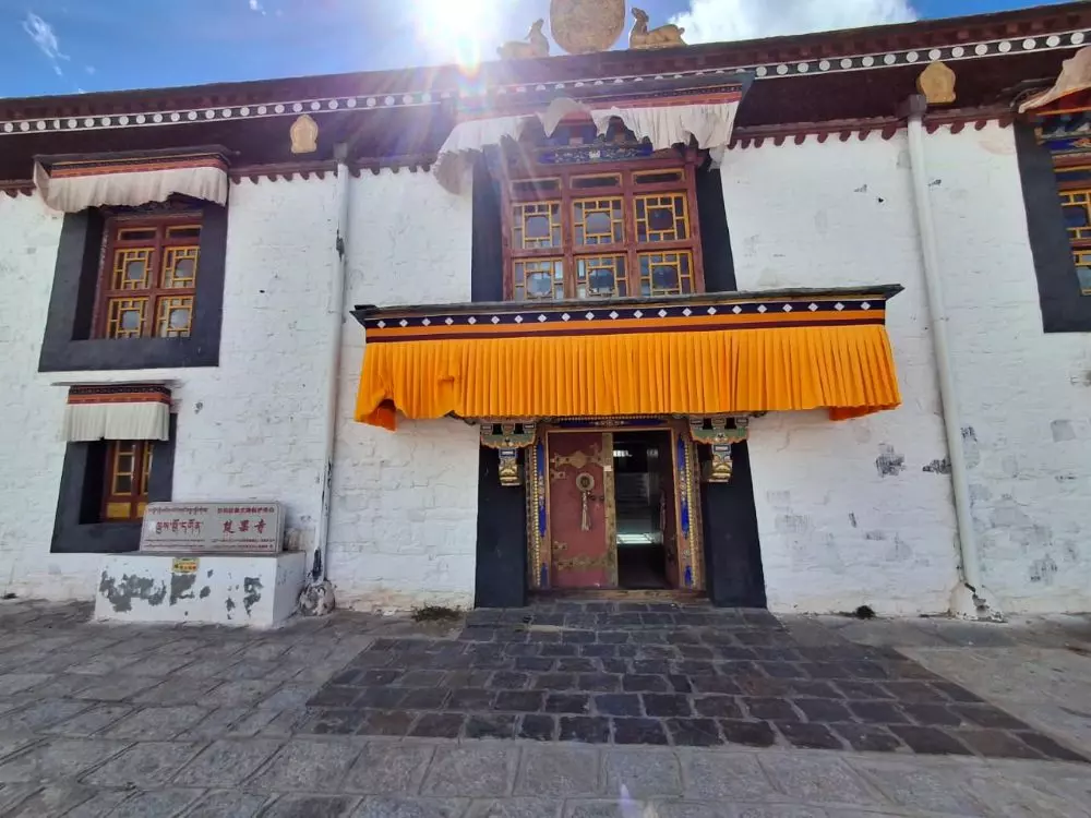
The monastery near the writer's hotel in Mansarovar. Photo: Jayanthi Madhukar
After a hot shower at the hotel, it was once again time to board a bus, this time for Lake Manasarovar. The hotel at Mansarovar was comfortable by the standards of the journey and stood opposite an old monastery in Ngari Prefecture. It was a tranquil place to recover. We spent two nights at Manasarovar before beginning the journey home. We went through immigration once again, tired but happy that we had completed the yatra.
Today, it is difficult not to think about the people who had travelled through the same stark landscape, reaching Gyirong Immigration Hall in Tibet with the expectation of crossing another border and continuing home.
They could have had no idea what was waiting for them.