




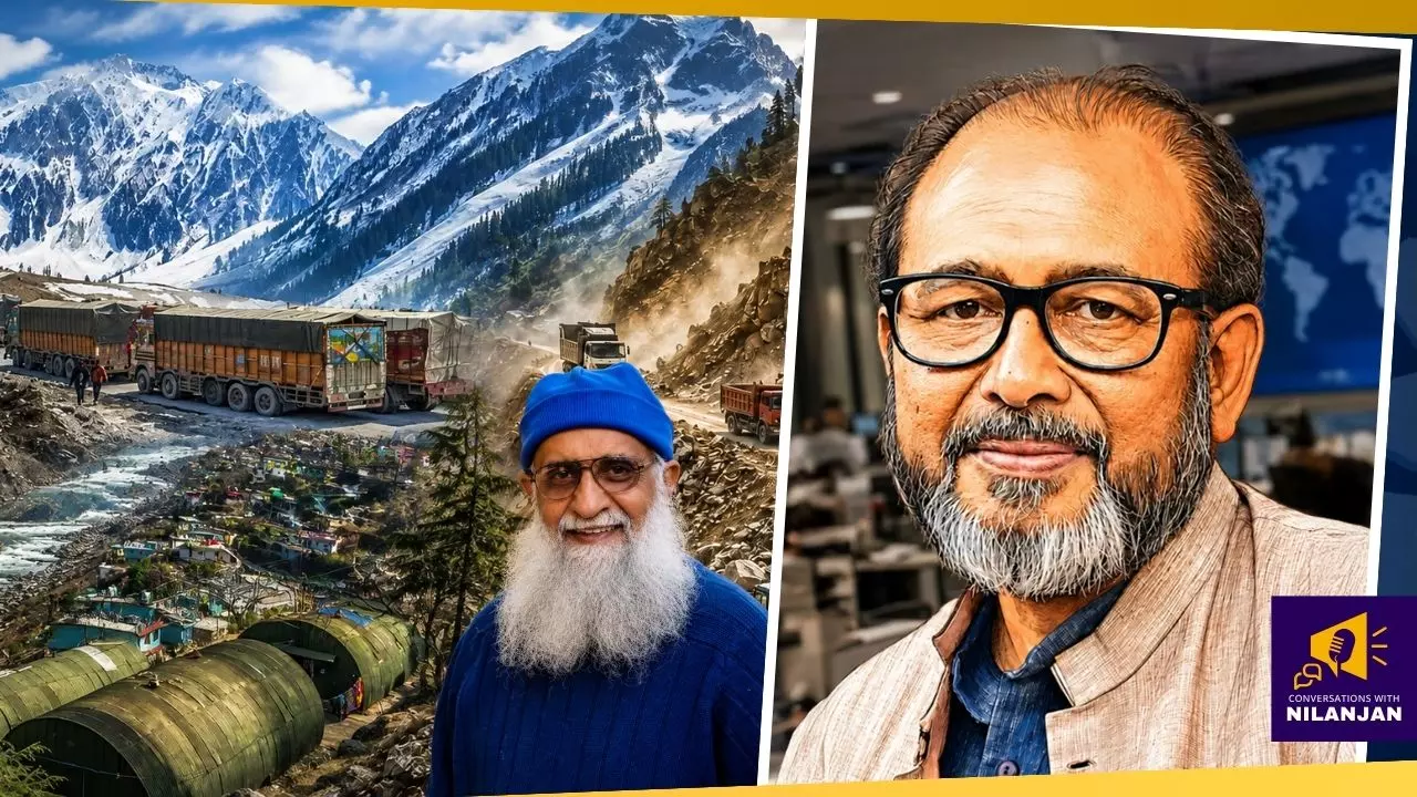
‘Nepal valley flooded twice in 14 months’: Expert slams ‘sheer madness’ of Himalayan development
Friendship Bridge destroyed twice: Environmentalist Ravi Chopra explains how reckless development pushes fragile valleys into repeated disasters, ruining lives

The recent glacier collapse and flash floods along the Nepal-Tibet border have killed over a thousand people and raised urgent questions about “development” in the fragile Himalayan region, with shared river basins carrying the risk directly into Uttar Pradesh, Bihar and West Bengal.
The Federal spoke to Ravi Chopra, former chairman of the Supreme Court-appointed committee on the Char Dham project, about what triggered the disaster, whether it could have been prevented, and why he eventually resigned from that committee.
The veteran environmentalist pointed out that the same Himalayan valley has been flooded twice in 14 months, destroying the same Nepal-China friendship bridge both times. And yet, no lessons have been learnt, leaving the situation of the Himalayas quite "desperate". Edited excerpts from the interview:
Are recent disasters like the one in Nepal an inescapable consequence of climate-induced extreme weather, or a direct reflection of a top-down development model? Or is it a bit of both?
It is definitely a bit of both, and I can explain that.
See, the hazards are up in the Himalayas, and the disasters are down in the valleys. In this particular case, for example, a massive section of a glacial wall collapses at a height of about 5,200 metres. It then rolls down — the vertical height may be about 2 to 3 kilometres, 2,000 to 3,000 metres. A mass of snow, ice, sediment and water begins to roll down that slope, the river valley.
That river valley is narrow. In some places, it’s extremely narrow. All this mass sometimes gets locked at an extremely narrow portion, forming a dam. Material continues to collect behind that dam. Eventually, the dam bursts and the mass moves forward. Each time a dam is blasted, its energy is transferred to the mass.
Also read: Nepal flash floods death toll rises to 1,344, nearly 4,900 still missing
By the time it hits the valley floor — meaning the Lhende stream — it has travelled a long distance. It has collected much more debris, much more water as it has come down, so it carries a huge amount of energy which it transfers to the river.
The river absorbs that energy and begins to slide down its bed. Barely 18 to 20 km downstream is the border between Tibet and Nepal. At that border there is a small town, Rasuwagadhi, and that’s where all the disaster takes place.
In February 2021, a small hydropower station and the Tapovan-Vishnugad dam in Chamoli district was destroyed. Two hundred workers in the tunnel died. It happened again in the Teesta in October 2024. It happened in Dharali last year. These disasters are going to happen with increasing frequency in the days to come. We’ve warned them. The government knows all this, and yet lessons are not learnt.
So the disaster has taken place down in the valley, where the houses have disappeared, the people have been swept away, the animals have been swept away, and a lot of infrastructure has gone — a dam, a solar power plant, a road, everything, including an immigration centre. So as I said at the beginning, the risk is up at the top and the disaster is down in the valley.
Another word of caution — most of these disasters take place in small streams. You may recall the Dharali disaster last year in Uttarakhand. The stream that joins the Bhagirathi Ganga at Dharali is itself very small. These small streams are very narrow, and that’s the same thing that happens in the lower ranges of the Himalayas — for example, the outer Himalayas at Mussoorie. Because streams there are small, narrow and steep, they can’t hold on to that mass, they don’t have enough space, and the mass just travels with great speed and energy.
The Himalayan environment, the whole region, is extremely sensitive. It is born from the bowels of the earth. Three ranges — the Shivaliks, the outer Himalaya, and the inner Himalaya — have emerged from the weak zone formed by the collision of the Indian plate and the Eurasian plate. We’ve known that for a long time. Therefore, the ideal kind of development in this region would be very different from the kind of development that takes place in the plains in the rest of the country.
Now, when you try to push that model of development into the Himalayan region — you want to build wide roads, you want to put in dams, you want to bring in ropeways, you want to bring a whole lot of tourists into this area and concentrate them on certain routes — then you are developing a whole economy in the valleys.
In the past, our pilgrims who went up to the shrines in the Himalayas took routes well above the river bed. When the British built a few roads, they built them at higher elevations. But in recent years, we’ve tended to build our roads along the rivers, next to the rivers. It may be cheaper, or it may just be that people like the idea of driving along a river. But that is a danger zone. That should not be done.
We’ve learnt this lesson, particularly if you look at 2013, when the Kedarnath disaster took place. A large section of the roads that were destroyed were right by the riverside.
Also read: Nepal’s deadliest disasters: From earthquakes to flash floods and avalanches
The Supreme Court committee that was formed after that disaster to look into its nature — of which I was the chairman — pointed that out. We made very clear-cut recommendations that dams should not be built in the high Himalayas. That region is what we call the paraglacial region — there are very small rivers in whose valleys the glaciers, while withdrawing, have left millions of tonnes of debris. In times of intense rainfall in these parts, the rivers will get flooded, they will start flowing down the steep valleys, they will come down and they will destroy whatever infrastructure you have created.
So we said, please don’t do that. They didn’t listen. In India, in February 2021, there was the disaster in Chamoli district in which a small hydropower station and the Tapovan-Vishnugad dam — the barrage — was destroyed. Two hundred workers in the tunnel died. It happened again in the Teesta in October 2024. It happened in Dharali last year, 2025. These disasters are going to happen with increasing frequency in the days to come. We’ve warned them. The government knows all this, and yet lessons are not learnt.
With Justice Nariman retiring and a new, less sympathetic judge coming in, the court gave a judgment in favour of the 10-metre width. I realised I could not save the Himalayas.
Take the case of this particular valley (in Nepal) — last year in July, exactly the same thing had happened. The Nepal-China friendship bridge had been destroyed. It was quickly rebuilt, and the same bridge, in the same place, was destroyed again this year. No lessons were learnt.
People on the government side say that despite environmental challenges, there still has to be development in the area, and they push for it. Would you say we can specify some limit to development — a terrain’s carrying capacity, beyond which it cannot bear more?
Yes, that work can be done, and that work has been done.
Though not specifically for any particular project or river valley or town — but if you go back to, I think it was 2008 or 2010, there was the GB Mukherjee Commission, appointed by the Planning Commission, and they had been very blunt. That commission said that if any project is proposed for this region which endangers the lives of the people who live here, the people of the region should rise up and reject that project. The problem is that the government is pushing a model of development that is not suited to this region.
What environmentalists have been arguing repeatedly is: Look, we want development, but we want sustainable development. You will recall the big debate that took place in 2020, when the Char Dham road leading to those shrines was going to be widened, and the Ministry of Road Transport proposed that it be widened to a carriageway on which vehicles would move — 10 metres width, and then you have to leave space on one side for drains and the other for crash barriers. So you actually need about 12, about 13 metres. And to get 13 metres width on a slope, you have to cut much more of the mountain.
Also read: Nepal floods: More Himalayan disasters are already being built
If the slope is steep, the recommendation has all along been to limit it to slopes less than 30 degrees, unless it’s essential — like for defence purposes — in which case you may go up to cutting a slope of 45 degrees. But in the Himalayas we’ve been cutting slopes of 60, 70 degrees — near vertical slopes. Sustainable development tells you — and this was the ministry’s own finding, their own recommendation — 5.5 metres. They don’t know yet. That is the difference between sustainable development and non-sustainable development.
You chaired the committee on the Char Dham project but eventually left it, and the project continued as it was. Does that not appear self-defeating?
Yes, the government does indulge in practices and technologies that are self-defeating.
I got on the committee reluctantly. I was nearing 75 at that stage. I didn’t really want to do it, but I got persuaded because people said, look, you can use this opportunity to save the Himalayas, otherwise it will be devastated.
I agreed, but when I saw that the court’s first judgment — the bench was the Nariman bench, and Justice Nariman said 5.5 metres, no more — the ministry just turned a blind eye to it. They did not respond to any of the directions being given by me, and ultimately they changed the regulations so that the defence ministry, which was happy with 7-metre width, was persuaded. The ministry of road transport convinced the defence ministry at a meeting: We are giving you 10 metres, you’ll have your 7 metres plus extra space, why are you opposing the 10-metre width? Both ministries agreed, and then they passed a new rule saying that the old notification of 5.5 metres was no longer valid — the road has to be 10 metres wide.
We now have not only dams, not only wide roads — we have a railway line going up to Karnaprayag, and pretty soon they say they’ll take it up to Badrinath. New townships have developed in Badrinath and Kedarnath. This is sheer madness.
At that stage, with Justice Nariman retiring and a new, less sympathetic judge coming in, the court gave a judgment in favour of the 10-metre width. I realised I could not save the Himalayas. So there was no point in my continuing on the committee as chairman.
What exactly is the state of the Himalayas at the moment?
The state of the Himalayas is quite desperate. The best indicator of that is the movement of people — for example, in the state of Uttarakhand, where most of this development is visible.
We now have not only dams, not only wide roads — we have a railway line going up to Karnaprayag, and pretty soon they say they’ll take it up to Badrinath. New townships have developed in Badrinath and Kedarnath. This is sheer madness. Badrinath is at the bottom of a valley which is prone to earthquakes. Avalanches can come from both sides. And the ground, if it shakes, it is all huge boulders and rubble. How do you build stable buildings there? This is also the most sensitive region in the Himalayas in terms of its size, and we remember the damage and destruction from the Uttarkashi earthquake in the early 1990s — it really devastated the entire area.
Also read: Nepal floods: Survivors recall terrifying escapes from raging waters
So the indicator is the movement of people out of the villages. In Uttarakhand, about 1,500 villages — roughly 10 per cent — are now called ghost villages, because everybody has moved out. There are many more in which there are just two or three families living. People are moving out of the mountains.
The government’s argument is that development will bring local industry and tourism, so people will stay, and desertion won’t continue. What’s your response to that — particularly on tourism being important here?
If that were correct — we pointed this out in the report on the Kedarnath disaster; we took the data district by district. Uttarkashi and Tehri, which had several dams, were the poorest districts in the state. So did the dams bring development?
Second — why have the men moved out? They’ve moved out in search of employment, to bring some income home. But what did they have to begin with? Where were they getting their livelihood from? From their farms, their fields, their forests. We had this unique system of panchayats controlling certain forests to meet their basic needs. That system was gradually weakened. There was almost no investment going into the farms and the fields, no agricultural investment.
Look at the neighbouring state of Himachal Pradesh. From the 1970s onwards, when YS Parmar became chief minister there, he focused on the farm economy. Today, something like 30 per cent of Uttarakhand’s population lives in towns in the plains, while in Himachal, the urban population is, I doubt, even 10 per cent. People have chosen to live there because they’re able to earn a living, and their living still comes from the farm.
Sometime ago — around 2020, when I presented the report on the Char Dham project — 52 per cent of Uttarakhand’s population was still dependent on agriculture, and something like 70 per cent practised agriculture, meaning not all of them were simply dependent on it. By contrast, Himachal had 10 per cent urban population, while Uttarakhand at that stage had 28 per cent urban population. So you see the difference — the approach of Himachal is to focus on the village, the approach in Uttarakhand is to focus on towns. Most of the investment in Uttarakhand has gone into the plains districts, the southern districts, not into the mountain districts.
Also read: Nepal disaster puts North Bengal’s vulnerability to Himalayan floods in focus
Take a town like Roorkee, very close to which I used to live. When I left, it used to be a small town of barely about 60,000 people, comprising the university, a CBRI (Central Building Research Institute), and a cantonment, the headquarters of the Bengal Engineering Group. One goes there now and just cannot recognise the town. The very fact that Roorkee now requires a bypass means it has become unmanageable.
The same problem afflicts Ramnagar, it afflicts Haldwani — all the towns which are railheads have this problem.
Take a town like Haridwar, also a major pilgrim centre, which is going to have the Kumbh Mela from the middle of January 2027, so it’s once again going to be in focus. The government says that because pilgrims are increasing every year in huge numbers, infrastructure has to improve so that there’s no chaos, no stampedes — so development is a necessity, not a luxury.
And why do we have to have five-star luxury in Kedarnath, at the base of a glacier? Why do we need this massive expansion of a township in Badrinath? Clearly, there’s no religious thought involved in this. Absolutely not.
The negative side of that is that the administration is unable to control the crowds, so it invades the river beds. There is no respect left for the Ganga river. Much of the Ganga’s floodplain is gone so that hotels can be accommodated. And in the process, it’s not just that pilgrims come on their own to do a pilgrimage — there is nothing like pilgrimage anymore. It is all what we can, at best, call religious tourism. In the name of religion, huge numbers of people are invited — “please come, look, we’ve got all these shrines for you”. But people who come to Uttarakhand and experience the difficulties are not a happy bunch that goes back. Lots of incentives are given. Take the Kumbh Mela that comes every year — it is a mass of humanity mobilised by a political party to come there. So it is political assertion. People are not coming to relax and unwind and get away from crowded urban areas — no way.
Given all this — having seen the Char Dham project so closely, having lived in Dehradun for decades, with your institute centred there — do you think Char Dham is more of a political project than a religious or spiritual one?
Absolutely, no question about it.
When we made the recommendation to the government that they should follow their own ministry’s advice to limit the width to 5.5 metres, we also said the drainage should be designed along the mountainside so that there is a pavement on which spiritually-minded pilgrims can walk. Every year, a few dozen, maybe about 100 people, actually trek all the way to the shrines. But the government did not bother to redesign the road to have a pavement for them. They did not redesign it to have trees for shade. They could not redesign it to put in drinking water fountains — nothing of the sort. So spirituality be damned, let’s bring the tourists in.
Also read: Nepal floods: What India can learn from Himalayan disasters
And why do we have to have five-star luxury in Kedarnath, at the base of a glacier? Why do we need this massive expansion of a township in Badrinath? Clearly, there’s no religious thought involved in this. Absolutely not.
Let’s move to the role of the three countries that share the Himalayan region — India, Nepal and China. There’s some agreement with Nepal on river water, but it seems to just skim the surface — no real partnership on sharing information and data in real time. How would you like to see India and Nepal take the lead here, and eventually bring China in too?
First of all, I am not a great fan of early warning systems. My fear, looking at how things actually happen, is that we’ll get an expensive early warning system with sensors installed somewhere, nobody will bother about maintenance, and when the disaster takes place, they won’t work.
But going beyond that — every disaster is an early warning system. If you pay attention to why that disaster happened — like I said at the beginning, we’ve had so many warnings, and these kinds of disasters are going to happen repeatedly — why don’t we move our populations to slightly higher elevations? We’ve now got data of these events, and we can map it — okay, 10 km away from the accident site, the water height rose 40 metres, 20 km away it rose 30 metres, and so on. We can plot these, and then say, okay, where it rose to, live above that. We should live above it.
Wherever you make a road, commerce follows; wherever commerce goes, habitations follow. So we need certain rules for where people can live and where they can’t. Now, when I say this to the government, they say, no, no, people don’t want to be relocated. But when the Tehri dam had to be built, the government forcefully relocated them — the entire town was submerged, and many villages too. Once that reservoir was built, the slopes of the reservoir started collapsing. I won’t go into the science of that, but they started collapsing. People complained to the Supreme Court, which passed an order saying these 27 villages have to be relocated. At that stage, the government said it didn’t have space to relocate them. So the government plays games with all this — there’s enough land to relocate people. And people themselves did not originally live by the riverside — they came to the riverside because the road had come there. Earlier, their habitations used to be at a slightly higher elevation; at best, they had fields down by the riverside, but now the whole family comes and lives there.
Also read: Nepal sought more glacier data from China months before deadly floods: Report
Coming to the specific question you’ve raised — the business of cooperation between the three countries — it’s definitely possible. We had the Indus Waters Treaty, which worked very well for decades. Only in recent years, that treaty seems to be falling apart. But all nations must do unto others as they would have others do unto them. We can’t behave like an upper riparian country towards our lower riparian neighbour, which is Bangladesh. If we want the Chinese to behave in a certain way towards us, the best thing to do is set the example by behaving better with Bangladesh. And even on the Indus Waters Treaty, we should settle whatever differences we have with Pakistan and sort that out, instead of keeping everything in a limbo and saying we have rescinded the treaty.
If the three countries (India, Nepal, China) can form a system to share information with each other, that is possibly the best way such disasters can be avoided. If we don’t do that, we will continue to debate these issues after they’ve happened.... Until there is intent from the governments, nothing is really going to move.
We have given local military units the powers to negotiate along the Indo-China border — there are a few points where local commanders can meet and negotiate. Similarly, why don’t we have local bodies for the people living on the Nepali side and the Indian side? They are literally the same people — we put in that artificial boundary. They have families on both sides. It’s in their interest to come to quick settlements. If we could set up those kinds of decentralised bodies to sort out differences, things might work better.
But if we’re just going to work on the scale of nations, then we need another body — and unfortunately, the UN has now fallen extremely weak. It cannot do what it used to, with peacekeeping forces, given all the violence and wars going on in the world today. The UN could set up an organisation, not unlike the World Trade Organization — a World River Sharing Organisation.
Also read: Nepal floods highlight growing glacial risks, need for scientific assessments: Experts
In the absence of information-sharing about what is happening — as you said at the beginning, this tragedy that unfolded in Nepal, that really affected the land and the people there, actually originated somewhere else, in Tibet — if the three countries can form a system to share information with each other, that is possibly the best way such disasters can be avoided. If we don’t do that, we will continue to debate these issues after they’ve happened — every few years, people like us will sit and discuss what can be done next, what steps should be taken to minimise the threat, because of the fragile nature of the ecology. But until there is intent from the governments, nothing is really going to move.
We’ve got a great opportunity — on September 14-15 we have the BRICS nations meeting in New Delhi. Why not have India raise it there? China is a member, India is a founder member, and Nepal probably is an observer. We’ve also got the Shanghai Cooperation Organisation. Why not bring it up there? The forums are there — the willingness is what’s required.