
Buffer zone: Confusion galore as Kerala publishes maps amid protests

The Kerala government has published the maps of the buffer zones around 22 areas protected as wildlife sanctuaries and national parks. According to Chief Minister Pinarayi Vijayan, the intention is to resist the “misinformation campaign” by the Opposition.
The maps contain the list of local bodies and the survey numbers of land and buildings in the buffer zone. Though the chief minister and other ministers have clarified that these are not the final ones to be presented in the Supreme Court, there is widespread uncertainty and confusion among people all over the state.
“No legal validity”
Across all districts, the buffer zones cover crowded residential areas, townships, agriculture land, commercial establishments, and government institutions. The current map was prepared by including only 0 to 1 kilometre around the 22 protected areas.
“This map has no legal validity. In several locations, the buffer zone lies in less than one kilometre (of the protected area). The Supreme Court has already rejected it and the government must find a way,” said Alex Ozhukayil, the chairman of Kerala Independent Farmers’ Association (KIFA), a Wayanad-based collective of settler farmers.
Also read: Munroe Island: This beautiful tourist spot in Kerala is sinking
He told The Federal that there is nothing new in the map published on Thursday. “These are the same maps that were rejected earlier. Going to the Supreme Court with the same maps will not be helpful,” he added.
“Aerial survey not enough”
The KIFA has demanded that the government prepare a comprehensive list of constructions, human habitation, and agricultural land within one kilometre of the protected sanctuaries and national parks and convince the Supreme Court that fixing a buffer zone is not practically possible in a state like Kerala. Organisations like KIFA argue that aerial survey is not enough to count the constructions and human habitation, but a field survey is required. The Chief Minister has already said a field survey would be conducted, and the final maps will be prepared only based on that.
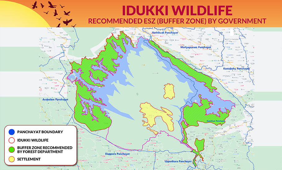
According to the farmers, an aerial survey will not serve the purpose because of the thick green cover of Kerala. “The map of Mathikettan Shola national park is an example. You can see that the map covers hardly 1,100 houses/buildings. In reality, there are 2,500 houses in the buffer zone,” said NR Jayan, vice-president of Devikulam block panchayat in Idukki district.
“The major crop in our area is cardamom. It needs shade. Hence, there are a lot of trees, which makes the green cover very dense. An aerial view will only give the sight of the green cover, and the constructions are barely seen,” Jayan told The Federal. The people demand a proper field survey that covers the entire construction and agriculture land.
State with 30% forest cover
There are 23 wildlife sanctuaries, national parks, and tiger reserves across the state, covering 3,084 sq. km, with 1,347 sq. km earmarked as ecologically sensitive. Kerala’s green cover and forest cover have only increased over time. As much as 30% of the total land area of the state is covered by forest. The Western Ghats cover 48% of the state, which has a 590 km sea coast.
Also read: Rescue, rice at a price: Kerala coughs up Centre’s flood relief bill
The state is also rich in water bodies, having 34 lakes and 44 rivers. The land area available for human habitation is very limited, considering the geographical features of Kerala, which is one of the states with the highest population density.
The maps published by the Kerala wildlife department have sparked widespread discontent among people. The areas covered under the buffer zones, as shown in the maps, prove that Kerala’s resistance against the buffer zone rule holds water. The state has been demanding that the same standards cannot be applied to all states for fixing buffer zones. Kerala’s geographical features and population density should be considered.
Impracticality of the rule
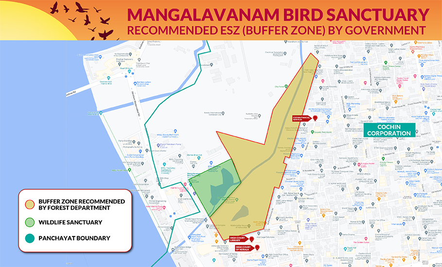
It is pertinent to see that the buffer zones cover even crowded cities and commercial areas. If the buffer-zone rule stipulated by the Supreme Court is strictly followed, even the Kerala High Court building must be shifted. The High Court is situated in the buffer zone of Mangalavanam bird sanctuary, the protected green cover in the very heart of the city.
Also read: NH expansion: Kerala, Centre in another round of war of words
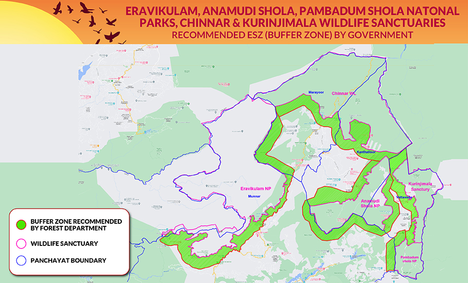
Similarly, human life will be impossible in districts like Idukki and Wayanad. which have multiple protected areas. Idukki has eight such areas, including national parks, tiger reserves, and sanctuaries.
Chief Minister Vijayan asserted that the people living in the buffer zones have nothing to worry about; human habitation, construction, and agriculture will be protected. However, the published maps have only escalated the worries of farmers living in the hilly terrains of the state, as those are incomplete.
