





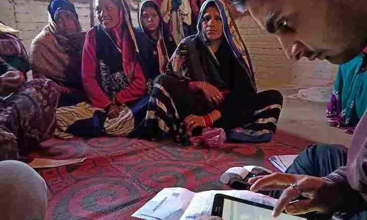
While technological advancements aim to make data collection fully digital and seamless, the practical and operational challenges unfolding on the ground are severe and multifaceted. | Representational image: iStock
While technology promises a seamless census, outdated maps, server crashes, and an overburdened workforce of schoolteachers are hampering the exercise
A census is never a mere mechanical head count of people living within legally mapped administrative borders.
It is the ultimate democratic exercise that measures a nation's present status to scientifically map out its future. Each census report is not just a statistical compendium but a precise socio-economic blueprint for how a country should distribute its resources, design welfare schemes, and overcome deep-rooted regional and structural disparities.
Today, this vital global exercise is undergoing a massive digital transformation. Yet, while technological advancements aim to make data collection fully digital and seamless, the practical, operational challenges unfolding on the ground are severe and multifaceted. Examining the ongoing census process in India, alongside its global context and evolving methodologies, reveals critical operational areas that require urgent systemic attention to ensure the data's ultimate effectiveness.
The word census originates from the Latin term censere, which means to assess, value, or estimate. In modern governance terms, it is defined as the official, comprehensive process of collecting, compiling, and publishing demographic, economic, and social data of all persons in a specific country at a specified time.
Recognising its foundational importance, countries around the world organise their census operations based on strict guidelines set by the United Nations Population Division, which strongly recommends a comprehensive count at least once every ten years.
While large and populous nations like India, the United States, and Canada maintain this traditional 10-year interval, other countries like Australia and New Zealand conduct it every five years to keep pace with rapid demographic shifts and high migration rates.
Census operation
Globally, a standard and scientific census operation is systematically planned and executed in three distinct, interconnected phases.
The first is the pre-enumeration phase, which involves drafting complex questionnaires, digitising maps, defining rigid administrative boundaries, and training the vast workforce required for field operations. The second is the enumeration phase — the core operation where field officials gather raw data directly from citizens through face-to-face interviews or secure digital portals, meticulously covering both housing characteristics and individual demographics.
Developing nations like India, Bangladesh, and several African countries still rely heavily on traditional face-to-face interviews, where enumerators physically visit every single household with standardised questionnaires.
Finally, the post-enumeration phase involves processing the massive volume of collected data, checking for logical errors, and conducting independent post-enumeration surveys to detect any missing information or coverage gaps. Only after these stringent quality checks are completed are the official reports verified and released to the public in thematic phases.
Why census data is needed
The immense expenditure of public money and human resources on this exercise is fully justified because its outcomes directly dictate a nation's survival, structural development, and daily governance. Modern policymaking relies heavily on accurate data regarding vulnerable groups, including children, women, and the elderly, to plan targeted healthcare, primary education, and robust pension schemes.
Central governments allocate crucial development funds and fiscal resources to states and local administrative bodies based on these population metrics and development indices.
Also read: Census, delimitation a 'single spectrum test' for democracy: GN Devy
Furthermore, in democratic setups, the delimitation of parliamentary and legislative constituencies, as well as the fair determination of reserved seats for marginalised communities, depends entirely on census data. It also guides academic research and macro-level infrastructure planning, helping planners decide where new schools, hospitals, industrial corridors, and public roads are critically needed.
Global contrasts in methodologies
There is a stark contrast between developed and developing nations regarding the logistical and technological approaches to conducting a national census. This operational difference is primarily visible in the data collection methods chosen and the nature of the workforce deployed to execute the task.
Developing nations like India, Bangladesh, and several African countries still rely heavily on traditional face-to-face interviews, in which enumerators physically visit every household with standardised questionnaires. In these regions, public school teachers and other government employees are legally mandated to perform census duties.
School teachers are historically chosen because they represent a highly educated, locally respected, and accessible workforce capable of interacting easily with the public, even in remote or culturally isolated rural areas.
Conversely, developed nations like the United States, the United Kingdom, Canada, and Australia do not pull teachers away from their regular academic responsibilities for census fieldwork. Instead, these countries predominantly utilise a self-enumeration method, in which the vast majority of citizens complete and submit their census forms independently via online portals or bymail.
Household visits by officials are kept to an absolute minimum. When field follow-ups are necessary to address non-responses, census bureaus issue public notifications and hire temporary contract workers on competitive hourly wages. Homemakers, retirees, and university students seeking part-time employment make up the bulk of this temporary, flexible workforce.
On another front, Nordic countries like Sweden, Norway, Denmark, and the Netherlands have completely abandoned traditional, physical fieldwork. No census official knocks on doors in these nations. Instead, they maintain centralised digital administrative registers that continuously and dynamically record births, deaths, addresses, employment changes, and taxes. During census years, sophisticated data-linking algorithms sync these various state databases to instantly generate comprehensive demographic reports.
Also read: Census 2027 to go digital with self-enumeration; 2-phase rollout from April 1
However, implementing this registry-based model in developing nations is currently impractical due to lower digital literacy rates, lack of complete formal documentation, and the absence of fully integrated, error-free national databases.
Evolution of Indian census
The history of population counts in India stretches back centuries, illustrating the region's long-standing administrative capabilities. Kautilya's Arthashastra and the Mughal-era text Ain-i-Akbari both document systematic data collection for state taxation and regional administration. However, the modern, scientific census began under British rule.
While the first non-synchronous population count took place in 1872 under Lord Mayo, the first synchronous, countrywide census was launched in 1881 under Lord Ripon. Since then, India proudly maintained an uninterrupted ten-year cycle, defying major world wars, economic depressions, and natural disasters.
Post-independence, the exercise gained strong statutory backing through the Census Act of 1948, managed centrally by the Office of the Registrar General and Census Commissioner under the Ministry of Home Affairs.
Widespread reports from teacher unions and regional observers highlight serious structural bottlenecks in field planning that require prompt operational modification.
The scope of the Indian census has evolved dramatically over the decades, tracking the country's changing developmental priorities.
The first census of independent India in 1951 focused heavily on the painful scars of partition and refugee rehabilitation. Over time, the focus shifted toward tracking literacy rates, labour force participation, and complex patterns of internal migration. In recent counts, the questionnaire has expanded significantly to evaluate modern living standards, capturing granular data on housing quality, access to clean cooking gas, banking penetration, internet availability, and smartphone ownership.
Operational challenges
While the current Indian census was launched with grand promises of being a cutting-edge digital exercise, the reality confronting field workers paints a complex and challenging picture.
Widespread reports from teacher unions and regional observers highlight serious structural bottlenecks in field planning that require prompt operational modification. The most glaring practical grievance is the poor quality of the Enumeration Block maps provided to field staff. Instead of precise, modern maps built on real-time GPS technology or high-resolution satellite imagery, enumerators are frequently sent out with decades-old, hand-drawn rough sketches.
Over the last decade, vast geographical changes have occurred across India, with new public roads built, urban areas expanded, and old properties sub-divided, but these working maps remain outdated. Landmarks noted on the sketches no longer exist on the ground, and ambiguous boundaries lead to overlapping claims, with multiple enumerators visiting the same household, causing severe confusion and wasted field hours.
Furthermore, a major operational challenge stems from the fact that field staff are sent into their assigned territories with virtually no baseline or foundational data. Enumerators do not receive a preliminary list of houses, buildings, or current occupants from existing local databases. They are expected to navigate unfamiliar territories blindly, manually numbering every single structure — including locked houses, shuttered commercial shops, and dilapidated, abandoned buildings—before any actual demographic data can be logged into the official mobile application.
This complete lack of pre-populated local data has created an uneven and overwhelming distribution of workloads. Nominally, an enumerator is supposed to manage up to 150 census houses. However, because there was no prior administrative data integration, field workers are discovering—only after completing the physical marking—that their assigned blocks contain upwards of 300 to 400 census houses.
To correct this mathematical miscalculation on the fly, local authorities have resorted to a highly demanding measure: redividing the blocks mid-operation and redistributing the excess houses to overburdened enumerators nearby. This short-sighted fix results in severe redundancy of labour.
Also read: Census 2027: Online self-reporting, mobile apps, and what it means for households
Enumerators who have already spent days verifying a territory find their completed work carved up and reassigned, forcing others to repeat the physical verification and marking process all over again.
Three-tiered ordeal
The structural demands of this fieldwork effectively require an enumerator to complete a gruelling, three-tiered physical routine in the field:
1. Mapping phase: Walking the entire area to make sense of ambiguous boundaries and outdated sketches.
2. Numbering phase: Physically marking, cataloguing, and numbering every residential, commercial, and abandoned structure.
3. Data collection phase: Conducting actual face-to-face interviews and digitally uploading individual household profiles via the app.
Fulfilling these requirements is exceptionally difficult because families are often away during day hours or shops are closed, requiring multiple return visits to the same address.
Yet, the system has allotted a tight window of duty leave for this monumental task. School teachers are left caught in an administrative vice, forced to execute these complex field operations while simultaneously adjusting their regular school timetables to ensure that institutional learning, daily classes, and student academics are not disrupted.
This operational chaos highlights a significant gap in coordination between the central census apparatus and local governance bodies. Local government institutions, such as village offices, panchayats, and municipal corporations; possess reasonably accurate, updated registers of local buildings, tax holdings, and residents.
While these local bodies are involved in the broader census network, their valuable micro-level databases are not effectively integrated into the pre-enumeration field planning phase. Had the census authorities actively utilised this existing local governance data to pre-populate the field maps and lists, the current confusion regarding boundaries and house counts could have been easily avoided.
By failing to fully leverage local administrative mechanisms during the initial layout, the process has become a logistical hurdle.
Bottlenecks, pan-India realities
Even when field workers manage to navigate these physical hurdles, the transition to mobile applications for data collection has run into severe infrastructural bottlenecks.
When hundreds of thousands of enumerators attempt to upload heavy demographic data simultaneously, the central servers frequently slow down or crash. Workers report waiting for hours just to save and sync the details of a single family. Furthermore, internet connectivity is notoriously weak in hilly terrains, forest fringes, and remote rural pockets.
While the app is designed to work offline, enumerators complain of data loss during subsequent synchronisation attempts. Compounding this financial strain, teachers are forced to use their personal smartphones and mobile data for official work, despite receiving minimal government allowances for technology maintenance.
The heavy reliance on schoolteachers remains one of the most heavily discussed aspects of the Indian census, as it inevitably affects institutional learning. Academic schedules break down when teachers spend consecutive weeks on field surveys, a crisis felt most acutely in understaffed rural primary schools. The pressure of balancing routine school duties and exam evaluations alongside strict census deadlines has triggered severe mental stress among educators.
Additionally, in certain sensitive regions, political anxieties surrounding citizenship registers have made the public hesitant to share personal details. When enumerators arrive without proper government-issued ID cards or a robust public awareness campaign backing them, citizens frequently refuse to cooperate, worsening the gridlock.
This is not an isolated regional crisis; it is a pan-Indian reality that reflects a systemic gap between technological ambitions and ground-level infrastructure.
Data from various states show that, whether in a rural hamlet in Uttar Pradesh, a dense urban pocket in Mumbai, the mountainous tracts of Arunachal Pradesh, or the highly literate wards of Kerala, enumerators face identical structural bottlenecks in software optimisation, boundary demarcation, and workload imbalances.
(The Federal seeks to present views and opinions from all sides of the spectrum. The information, ideas or opinions in the articles are of the author and do not necessarily reflect the views of The Federal)