


India may look bigger on world maps after UN resolution; here’s why
The resolution promotes equal-area projections while leaving borders, disputed territories and political maps untouched

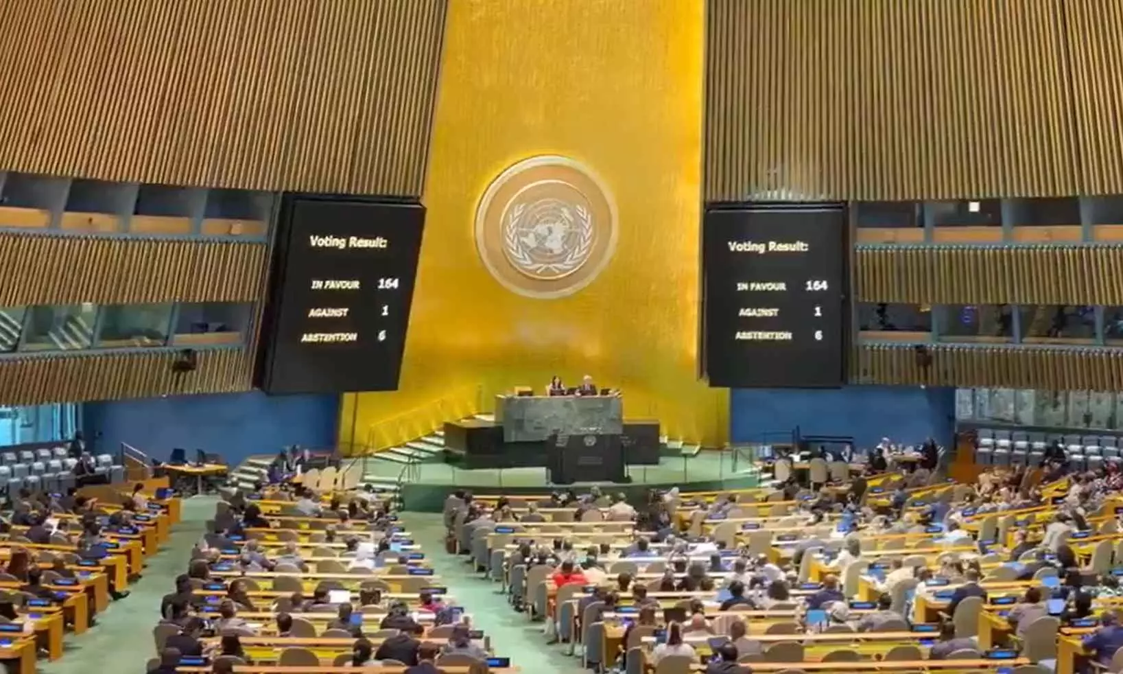
Following the adoption of a resolution by the United Nations, India could look bigger on the world map. Not because it is gaining land, but because the way the world is mapped could be changing.
The United Nations General Assembly (UNGA) has backed the wider use of maps that show the actual relative size of continents and countries more accurately. India voted in favour of the resolution, but made it clear that its support should not be read as an endorsement of any particular map or as a change in how its territorial boundaries are shown.
Why does India look smaller on world maps?
The basic problem with mapping is that Earth is round, but a world map is flat. Whenever a globe is flattened, some distortion is inevitable. The Mercator projection, developed by Flemish cartographer Gerardus Mercator in 1569, was designed for navigation. It made it easier for sailors to plot routes because it preserved directions and angles.
But it also makes landmasses farther from the Equator appear much larger than they really are.
Also read: UNGA: India, 163 countries vote for new world map with bigger Africa; US votes against
This is why Greenland can look almost as large as Africa on a Mercator map, even though Africa is about 14 times larger.
Europe, North America and other regions in the northern latitudes are similarly exaggerated, while countries closer to the Equator appear relatively smaller.
India falls into the latter category.
So, will India actually become bigger?
No, India's geographical area is not changing. What changes is how it looks in comparison with other countries and continents.
On an equal-area map, countries and continents are shown in proportion to their actual surface area. As the exaggerated size of regions such as Europe and North America is reduced, India will appear relatively larger.
What is the Equal Earth map?
One of the projections highlighted in the UN debate is Equal Earth, developed in 2018.
As its name suggests, it is an equal-area projection. It gives a more realistic picture of the relative size of landmasses while still keeping the shapes of continents recognisable.
Africa, in particular, looks much larger than it does on a Mercator map. Europe and North America look smaller, while countries such as India and regions across the Global South gain more visual weight.
But India has been careful about this distinction.
Also read: Google Maps rolls out AI-powered features for hassle-free navigation in India
Indian diplomat Raghoo Puri said India's vote supports the broader use of equal-area projections, not Equal Earth specifically or any other individual map.
Is the UN replacing the Mercator map?
The resolution, adopted by 164 votes to one, is not a ban on Mercator. It does not force countries, schools or technology companies to switch to Equal Earth.
Instead, it encourages governments, educational institutions, international organisations and technology companies to use equal-area maps when comparing the size of landmasses and to explain the limitations of different map projections.
What about India's borders?
India supported the resolution while making its position on political maps very clear.
The Ministry of External Affairs said the UN measure does not deal with international boundaries, disputed territories or place names. India reiterated that its sovereign territory, including the Union Territories of Jammu and Kashmir and Ladakh, must be depicted according to its official map.
So, the UN vote does not alter India's borders or endorse any particular depiction of them.