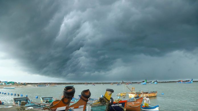
Cyclone Sitrang to hit Bengal-Bangladesh coast by October 25

A low-pressure system over the Andaman Sea is likely to intensify into a cyclonic storm and reach West Bengal-Bangladesh coasts on October 25, causing wind gusting of 110 km per hour, the India Meteorological Department (IMD) said on Friday (October 21). The cyclone that is likely to form has been named Sitrang.
According to Sanjib Bandopadhyay, deputy director-general of Regional Met Centre in Kolkata, the system is likely to cause light to moderate rain in Gangetic West Bengal, with isolated heavy rain in the coastal districts of South 24 Parganas, North 24 Parganas and Purba Medinipur.
He said that it is likely to cause light to moderate rain in Kolkata on October 24 and 25.
“Wind speed of 45 to 55 km gusting to 65 kmph will occur in the coastal districts of South 24 Parganas, North 24 Parganas and Purba Medinipur on October 24, while on October 25, wind speed will reach 90 to 100 kmph gusting to 110 kmph,” he told reporters.
Wind speed of 30 to 40 kmph gusting to 50 kmph will occur in Kolkata and adjoining districts of Howrah and Hooghly, he said.
“It will not be a super cyclone and further movement of the system will be updated by the IMD in due course,” Bandopadhyay said.
Evacuation underway
Super cyclone Amphan, which barrelled through the coastal districts of West Bengal in May 2020, had a wind speed of 185 kmph when it made landfall near Sundarban, officials said.
At a high-level meeting, West Bengal’s Chief Secretary HK Dwivedi directed South 24 Parganas, North 24 Parganas, Purba Medinipur, Paschim Medinipur and Hooghly districts to take necessary precautions in the wake of the forecast.
In view of the situation, the government has cancelled leaves of all senior officers in the said districts and those in the Kolkata Municipal Corporation (KMC) and Kolkata Police.
While people in low-lying areas are being evacuated to safe shelters, control rooms will be opened in the south Bengal districts.
Also read: Cyclone Sitrang to skirt Odisha, hit Bengal-Bangladesh coast on Oct 25
Twenty teams of the State Disaster Response Force (SDRF) and 15 teams of the NDRF will be on standby.
Kolkata’s Mayor Firhad Hakim said his team is ready to face any eventuality.
“All community halls have been asked to remain open. We will start using mikes to alert people. All pumping stations will be active to drain out accumulated water. We are also preparing cyclone shelters,” he told PTI.
People living in dilapidated buildings in Kolkata have been asked to move out, another official said.
Heavy rainfall in Odisha
Earlier in the day, the IMD said that the cyclone may skirt the Odisha coast and steer towards Bengal and Bangladesh.
Odisha’s Revenue and Disaster Management Minister Pramila Mallick said all districts and coastal region authorities were directed to be prepared to deal with the emerging situation.
The system is likely to trigger heavy rainfall when it crosses parallel to the state’s coast on Monday.
Mallick said personnel of the fire service department, the ODRAF and NDRF are on standby for any emergency situation.
Odisha’s Special Relief Commissioner (SRC) PK Jena appealed to the people not to panic as the cyclone is likely to be 200 km away from the states coast at Dhamra Port in Bhadrak district when it will head towards West Bengal-Bangladesh coasts.
“The Odisha government is in touch with the NDRF, Indian Navy and Coast Guard in view of the forecast. Odisha coast may experience maximum 50 to 60 kmph wind speed when the weather system crosses parallel to the states coast,” he said.
The IMD in its forecast said that the low-pressure area over Andaman Sea is likely to move west-northwestwards and concentrate into a depression, and deep depression thereafter on October 23.
The system is very likely to recurve northwards subsequently and intensify into a cyclonic storm over westcentral and adjoining eastcentral Bay of Bengal by October 24.
“Thereafter, it is likely to move north-northeastwards and reach near West Bengal-Bangladesh coasts on October 25, skirting Odisha coast,” the Met department said in its forecast.
The Northeast, including south Assam, east Meghalaya, Nagaland, Mizoram, Manipur and Tripura, will receive rainfall on October 24, 25 and 26 under the impact of the system.
Fishermen have been advised not to venture into the sea from October 23 and those who are at sea have been asked to return to land.
(With inputs from agencies)

