Cyclone Yaas: Full moon could lead to devastating storm surge
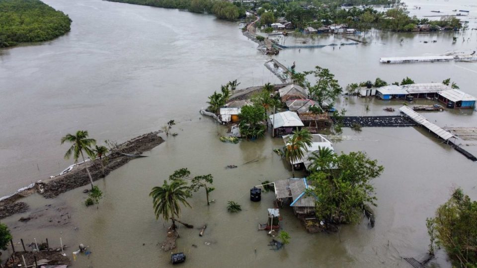
He said if the cyclone makes landfall during high tide, it could lead to coastal flooding and breach of embankments, causing massive devastation

A full moon and trails of destruction left by previous back-to-back cyclones are raising concerns among authorities as they brace for ‘Yaas’, which is expected to make landfall near Dhamra Port in Odisha on Wednesday.
Officials and public representatives overseeing the disaster management preparedness said their main concern is that Yaas is coinciding with the full moon, when the tide is high.
“The storm surge could be higher and more devastating this time as the cyclone is coinciding with the spring tide phase on a full moon day,” said Jayanta Naskar, an MLA from Sunderban’s Gosaba.
He said if the cyclone makes landfall during high tide, it could lead to coastal flooding and breach of embankments, causing massive devastation.
Also read: Taming the waves: How technology can make a difference
The sea and rivers are expected to see high tides for about two hours from 9.30am and again for the same duration from 9pm on Wednesday (May 26), the day Yaas is likely to make landfall.
The met office predicted it would hit the shores early Wednesday morning. At the time of the landfall, the wind speed is expected to be 155-165kmph, increasing to 185kmph.
At 1130 hrs IST, Cyclone ‘Yaas’ is about 220 km south-southeast of Paradip. To intensify further and cross north Odisha-West Bengal coasts close to north of Dhamra and south of Balasore, during 26th noon as a Very Severe Cyclonic Storm. pic.twitter.com/zTtUNddPyl
— India Meteorological Department (@Indiametdept) May 25, 2021
It is also expected to cause a storm surge of two to four metres along the coastline of East Midnapore and one to two metres in South 24 Parganas.
Around a 35-km stretch of embankments in Sunderbans areas of South 24 Parganas and a 30-km stretch in North 24 Parganas have been identified as vulnerable, irrigation department sources said. Similarly around 50km of the embankment in East Midnapore district too is at risk.
Also read: Amphan generates momentum for MGNREGA works in West Bengal
The repair of the embankments has been taken up on a war footing, the officials said.
During last year’s Amphan around 96,000 hectares of farmland were damaged and at least five lakh farmers were affected due to ingress of saline water into agricultural fields.
This time there is a greater risk of coastal flooding though Yaas is expected to be less intense than Amphan, which clocked sustained wind speeds of 240kmph for about three devastating minutes.
Further, severe cyclonic storm Bulbul of 2019 and super cyclonic storm Amphan of 2020 have depleted mangrove cover of Sunderbans, exposing the delta, a UNESCO World Heritage Site, to the vagaries of nature.
Amphan had destroyed 1,200sqkm of the Sunderbans’ 4,263sqkm forest cover.
A 2013 study estimated that a mangrove forest cover could reduce the intensity-level of a Category 5 storm to Category 3. Besides, the trunks of the mangrove trees also help slow down the tides by working as speed-breakers.
“A massive plantation drive was taken up by the state government in Sunderbans after Amphan. But these saplings are yet to mature to work as a shield against a surging storm,” said Prasanjit Mandal of Sunderban Foundation, a local NGO.
Meanwhile, the state government has launched a massive evacuation drive mainly in the three coastal districts of North and South 24-Parganas and East Midnapore, with a target to move around 10 lakh people to 4,000 cyclone centres.

