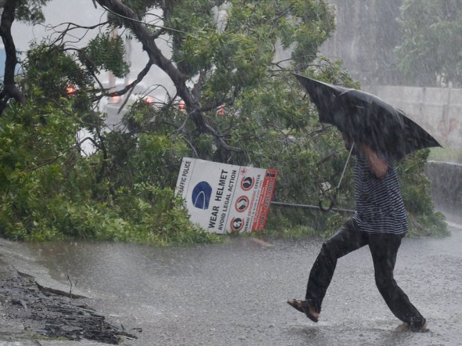
Cyclone Burevi: IMD issues red alert in four Kerala districts
The Indian Meteorological Department (IMD) has issued a red alert in four districts of Kerala — Thiruvananthapuram, Kollam, Pathanamthitta and Alappuzha — for December 3 in the view of tropical cyclone Burevi making a landfall in the coastal regions soon.

The India Meteorological Department (IMD) has issued a red alert in four districts of Kerala — Thiruvananthapuram, Kollam, Pathanamthitta and Alappuzha — for December 3 in view of the tropical cyclone Burevi making a landfall in the coastal regions soon.
Burevi is the second cyclone in Bay of Bengal within a week after cyclone Nivar. It is likely to cross Sri Lanka coast on Wednesday night. The Lankan administration has evacuated 75,000 people from the east coast as it braces for the cyclone.
The tropical cyclone is expected to cross south Tamil Nadu between Kanyakumari and Pamban early on Friday (December 4), the IMD had stated earlier.
The Sri Lankan government is anticipating extensive damage to coastal buildings and power lines and flash floods. The country’s disaster management centre has advised people living near the cyclone’s path to stay indoors.
In India, the IMD also issued ‘heavy to very heavy rainfall’ alert for places in Tamil Nadu and Kerala.
Burevi is unlikely to be as intense as Nivar, IMD Director-General Mrutunjay Mohapatra said.
Related News: Another cyclone to hit TN after Nivar
The Cyclone Warning Division of the IMD said a deep depression intensified into cyclonic storm Burevi on Tuesday evening.
It is very likely to cross the Sri Lanka coast close to Trincomalee during the evening or night of December 2 as a cyclonic storm, with a wind speed of 75-85 kilometres per hour gusting to 95 kmph, the IMD’s Cyclone Warning Division said.
Cyclonic Storm ‘Burevi’ over southwest Bay of Bengal about 240 km east-southeast of Trincomalee (Sri Lanka), 470 km east-southeast of Pamban (India) and 650 km nearly east-northeast of Kanniyakumari (India) at at 0530 hrs IST of today, the 02nd December 2020 pic.twitter.com/HXsQ5JKTls
— India Meteorological Department (@Indiametdept) December 2, 2020
“It is very likely to move nearly westwards thereafter, emerging into the Gulf of Mannar and adjoining Comorin area on 3rd December morning. It would then move nearly west-southwestwards and cross south Tamil Nadu coast between Kanyakumari and Pamban around early morning of 4th December,” it said.
“Heavy to very heavy rainfall at isolated places very likely over north Tamil Nadu, Puducherry & Karaikal and north Kerala & Mahe on 2nd & 3rd December; isolated heavy rainfall likely over north coastal Tamil Nadu on 1st December and over north Kerala & Mahe on 4th December,” IMD tweeted.
In another tweet, it wrote, “Heavy to very heavy rainfall at isolated places very likely over Lakshadweep during 3rd and 4th Dec; heavy rainfall at isolated places likely over south coastal Andhra Pradesh during 2nd & 3rd December, over Rayalaseema on 3rd December and over Lakshadweep on 5th Dec.”
In an update on Wednesday (December 2) morning, IMD said, “Cyclonic Storm ‘Burevi’ over southwest Bay of Bengal about 240 km east-southeast of Trincomalee (Sri Lanka), 470 km east-southeast of Pamban (India) and 650 km nearly east-northeast of Kanniyakumari (India) at 0530 hrs IST of today, the 02nd December 2020 (sic).”
Cyclonic Storm ‘Burevi’ over southwest Bay of Bengal about 240 km east-southeast of Trincomalee (Sri Lanka), 470 km east-southeast of Pamban (India) and 650 km nearly east-northeast of Kanniyakumari (India) at at 0530 hrs IST of today, the 02nd December 2020 pic.twitter.com/HXsQ5JKTls
— India Meteorological Department (@Indiametdept) December 2, 2020
“Cyclone Storm “Burevi” lay centered about 330 km Esat-Southeast of http://Trincomalee. To cross Sri Lanka coast close to Trincomalee on 2 Dec. evening/night. To emerge into Gulf of Mannar on 3rd Dec. morning & cross south TN between Kanniyakumari and Pamban on 4th early morning (sic),” it had posted earlier.
Cyclone Storm “Burevi” lay centered about 330 km Esat-Southeast of https://t.co/grfj6Lbre3 cross Sri Lanka coast close to Trincomalee on 2 Dec. evening/night. To emerge into Gulf of Mannar on 3rd Dec. morning & cross south TN between Kanniyakumari and Pamban on 4th early morning. pic.twitter.com/COgcW1R0AD
— India Meteorological Department (@Indiametdept) December 1, 2020
(With inputs from PTI)

