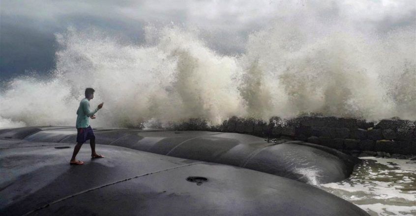
Cyclone Gulab inches closer; Odisha sets zero casualty target, evacuation drive underway

Hours before cyclone ‘Gulab’ makes landfall in Odisha, Chief Minister Naveen Patnaik on Sunday set a ‘zero casualty’ target in the vulnerable districts of the state, where rainfall activity started in the southern and coastal regions under the influence of the weather system.
The cyclone, the second to hit the state in four months after ‘Yaas’ wreaked havoc in May, is likely to make landfall between Gopalpur and Kalingapatanam in Andhra Pradesh around midnight, the India Meteorological Department said. It lay centered about 125 km southeast of Gopalpur and 160 km east of Kalingapatnam, the Met office said, adding, the system is moving at a speed of 18 kmph in the sea.
After the landfall, the system is likely to maintain the cyclonic storm intensity with slight weakening of wind speed during the subsequent 06 hours over south Odisha and adjoining north coastal Andhra Pradesh. It is likely to move west-northwestwards across south Odisha and south Chhattisgarh and weaken gradually into a Depression during the subsequent 12 hours.
Prime Minister Narendra Modi took stock of the situation and in a conversation with Andhra Pradesh CM YS Jagan Mohan Reddy has assured all support. Taking to Twitter, PM Modi wrote, “Assured all possible support from the Centre. I pray for everyone’s safety and well-being.”
The cyclone, named Gulab on the recommendation of Pakistan, is fast approaching.
Odisha’s southern and coastal regions recorded heavy rainfall on Sunday morning. It is likely to move nearly westwards and cross north Andhra Pradesh-south Odisha coasts with maximum sustained wind speed of 75-85 kmph gusting to 95 kmph, around midnight.
The landfall process will commence from late evening of Sunday, the IMD said, while issuing a Red Message (extreme rain). The current speed of the system is 18 kmph. The Odisha government has already mobilised men and machinery, and launched an evacuation drive in seven identified districts in the southern parts of the state.
As many as 42 teams of the Odisha Disaster Rapid Action Force (ODRAF) and 24 squads of the National Disaster Response Force (NDRF), along with about 102 teams of fire brigade personnel, have been dispatched to the seven districts — P Gajapati, Ganjam, Rayagada, Koraput, Malkangiri, Nabarangpur and Kandhamal, Special Relief Commissioner (SRC) P K Jena said.
Ganjam is expected to be severely affected by the cyclonic storm, and 15 rescue teams have been deployed in that area alone, Jena said.
Besides, 11 fire service units, six teams of the ODRAF and eight of the NDRF are on standby for emergency purposes, he said. Over the next three days, the sea condition will be rough to very rough and fishermen in Odisha, West Bengal and Andhra Pradesh have been asked to not venture into east-central and adjoining northeast Bay of Bengal and Andaman Sea. PTI AAM RBT
Gulab will be the third cyclone formed this year since May, with Tauktae (May 14 and 19) developing in the Arabian Sea and Yaas (May 23 and 28) in the Bay of Bengal Sea a few days later.
26/09/2021: 10:15 IST; Light intensity rain/drizzle would occur over and adjoining areas of Nagar, Laxmangarh, Rajgarh (Rajasthan) during next 2 hours. pic.twitter.com/lCTiIkP3gs
— India Meteorological Department (@Indiametdept) September 26, 2021
Skymet said that while the cyclone season begins in October, we are at the fag end of September and since the sea surface temperatures usually become favourable now, it is not rare for us to see cyclones at this stage.
Kendrapara, Jagatsingpur, Cuttack, Bhubaneswar, Khordha, Puri, Ganjam, Gajapati, Kandhmal and Rayagada are likely to bear the maximum brunt. In Andhra Pradesh, Srikakulam, Vijayanagaram, Visakhapatnam, East Godavari, West Godavari, Guntur and Krishna may receive heavy downpour with strong winds.
The IMD has told fishermen not to get deep into the sea from September 25 to September 26.


